Name of the site: Belate
Protection categories: Included in SCI ES2200018 Belate. Listed as Protected Non-developable Land due to its Environmental Value, Wetlands, in Navarre’s Land Planning Programmes 2, “Atlantic Navarre” and 3 “Central area”.
Location: Baztan and Ultzama.
Region: Navarre
Coordinate reference: 30TXN1166, 30TXN1167, 30TXN1266, 30TXN1267.
Surface area of the wetland: 40.31 hectares.
Altitude: an average of 835 m.
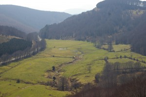
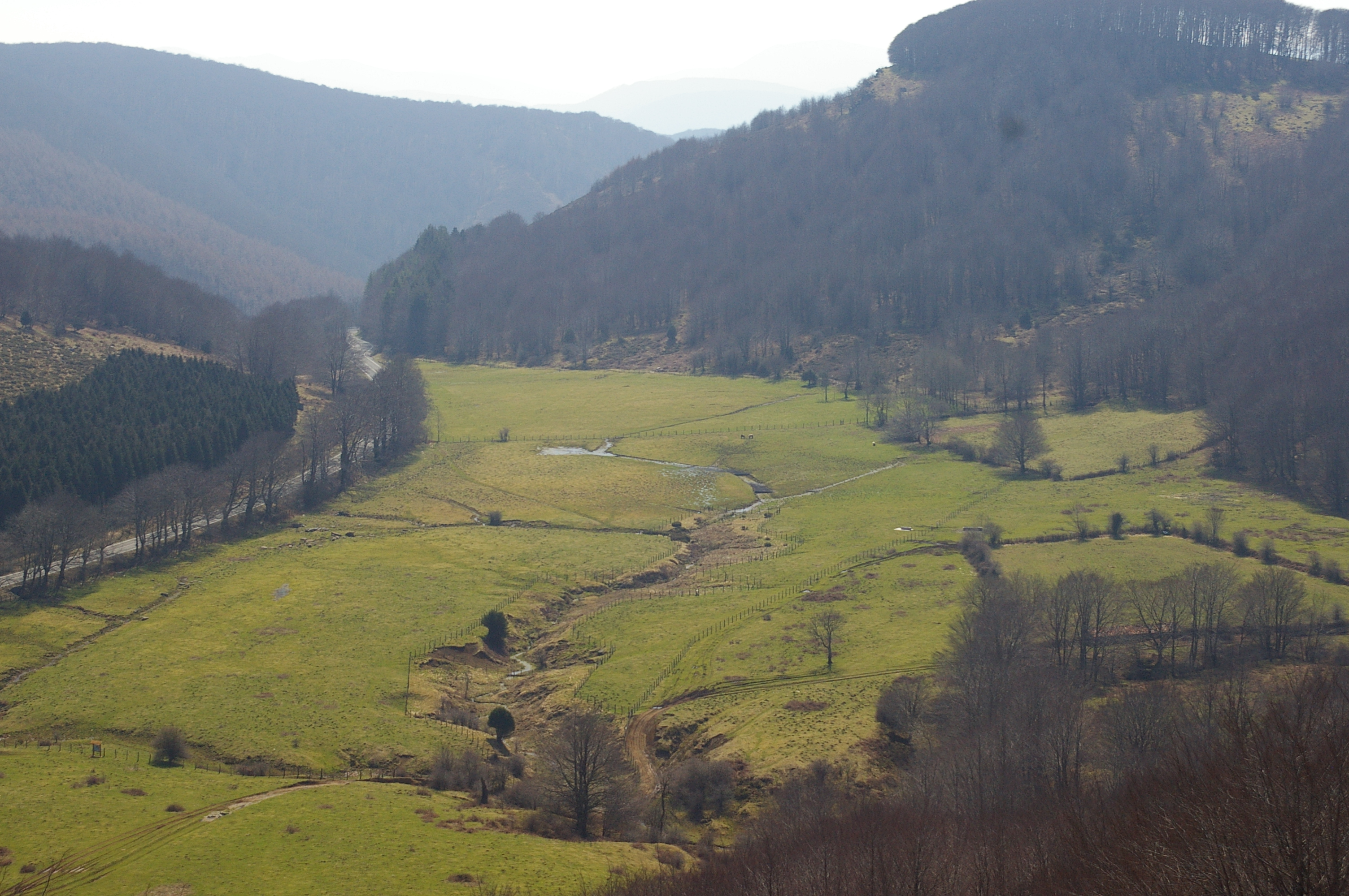
This site is a complex area covering more than 40 ha, located in an enclosed valley (“El Cerrado”) and surrounded by summits of between 900 and 1,400 m, on the Bay of Biscay-Mediterranean watershed. It is a mosaic of peat-forming environments, areas with dry soil and a peat deposit, located in an enclosed basin drained by a stream that disappears into a karst sinkhole.
The site has a diffuse water supply from the hillsides and a few springs, whilst natural drainage is essentially provided by sinkholes in the north and southeast. The valley consists of two, hydraulically independent sub-basins. The water reaches each from several springs or diffuse areas of water flow and disappears via sinkholes:
- The main sub-basin is set around the stream that appears as a diffuse brook from the slope that seals the enclosed valley to the South, where the peatland is, and then descends to the North in a highly defined fashion. Just before it sinks, it receives water from a less important side stream descending from the West. The deep furrow that the stream has created on the floor of the enclosed valley is striking. This erosion has caused small marshy areas to appear on the inclines which are of great importance because they are currently home to some of the main communities of peat-forming vegetation in the Belate area.
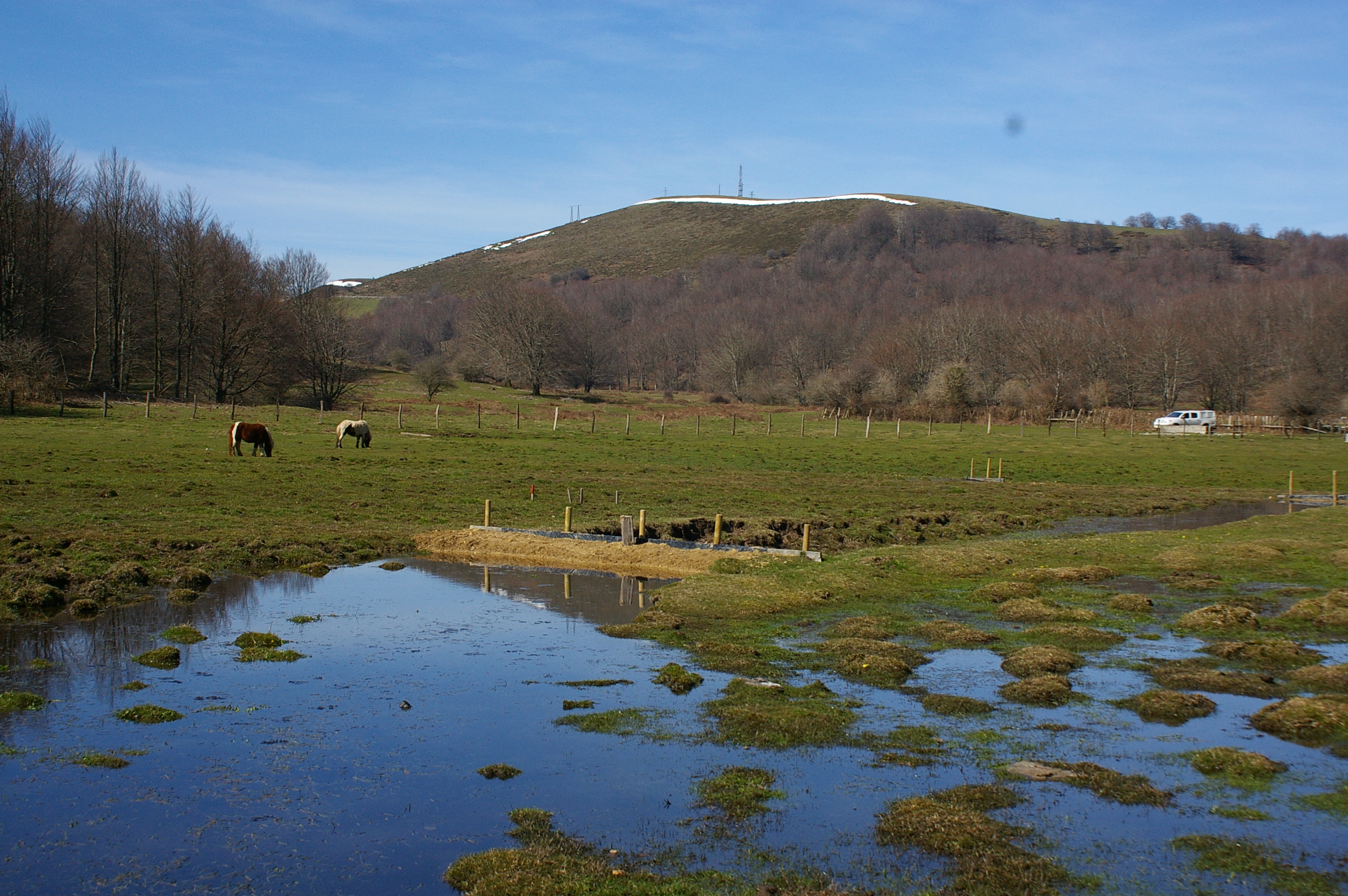
- The western sub-basin is formed by at least three brooks. It is interesting to note that it has absolutely no relation with the main sub-basin, where the peat deposit is found. On the westernmost edge of this sub-basin, several brooks surge from the colluvium formed on the lower half of the slope by ofites. Two of these are continuous and have considerable flow before disappearing into two sinkholes in the North-Northwest. There are a few other depressions where water emerges, giving rise to mires. A third, intermittent brook at the base of a gentle stream bed also collects the diffuse runoff that runs down from the centre of the sub-basin to the sinkhole in the south.
According to the bibliography and the accounts of people who know the area, the mire has changed greatly, particularly in the last 30 years.
The area is now basically covered with meadows, peppered with enclaves with mires and brooks. The true peatland in Belate is in the south and only covers a minimal part of the area demarcated (0.255 ha). There now barely remain any signs of peat-forming vegetation, although there is still a significant peat deposit.
The building of the road has forced the waters emerging at the feet of the slopes of Monte Matracola to drain southwards, along the ditch lining the road, joining the water in the ditch on the other side. These waters would originally have fed the main sub-basin.
- MOST IMPORTANT VALUES
Uniqueness
Belate has one of Navarre’s most significant peat deposits.Biological and ecological values
The presence of species of flora of special relevance, such as Alopecurus geniculatus, Barbarea intermedia, Carex brizoides, Carex hostiana, Equisetum fluviatile, Arnica montana and Senecio doronicum, is significant.It is also an important site for the conservation of the Habitats of Community Interest 6410 and 7140.
Historical and paleoecological values
There is a palynological study of this deposit (Peñalba 1989), providing one of the bases of the scant knowledge that we have of the evolution of vegetation in the north of the Iberian peninsula during the Quaternary period. The study is a historical record of great interest when it comes to learning about the climate and vegetation of the past, not to mention the impact of human presence in the region.Habitats of Community Interest
Hábitat 6230* Formaciones herbosas con Nardus, con numerosas especies, sobre sustratos silíceos de zonas montañosas (y de zonas submontañosas de la Europa continental) 6410 Prados con molinias sobre sustratos calcáreos, turbosos o arcillo-limónicos (Molinion caeruleae) 7140 «Mires» de transición Flora
A total of 204 taxa (167 vascular plants and 37 bryophytes) have been detected in the different environments sampled at the Belate site, although some of those cited by Biurrun (1999) and Heras (1992) have not been seen since, such as Menyanthes trifoliata.Belate is home to the larger part of those species native to peatlands and mires in Navarre. The most notable peat-loving taxa are Eriophorum angustifolium and Carex hostiana; it is also interesting to mention the existence of rare species specific to hydrophilic grasslands (Carex brizoides, Senecio doronicum) and waterlogged, nitrified soils (Alopecurus geniculatus, Barbarea intermedia) at the site.
Fauna
Belate is home to sufficient species as to consider it an area of special interest for the conservation of Odonata in Navarre. Three species stand out above the rest: Coenagrion mercuriale, Coenagrion scitulum and Sympetrum flaveolum. Coenagrion mercuriale is included in Annex II of the Habitats Directive and is also listed as “vulnerable” in the Red Book of Invertebrates of Spain. Both Coenagrion scitulum and Sympetrum flaveolum are also listed under the IUCN Category “Vulnerable” in the Red Book of Invertebrates of Spain. Belate also stands out because the woodland of ecological interest that surrounds the site is home to the coleopteron Rosalia alpina, included in Annex II of the Habitats Directive.- PHOTOS